To: Congressional House Committee on Natural Resources
From: Nancy Freeman
P. O. Box 934
Green Valley, AZ 85622
520-471-0197
nanfree24@hotmail.com
Date: May 20, 2013
Subject: Comments on HR-687
What if we were to create a sustainable Earth that would continue to be livable for healthy human beings for another hundred years? If this is a reasonable goal, destroying trees and natural watersheds in our National Forests is not an option. Trees of our forests are the Earth's sentinels protecting and ensuring the continuation of life. Trees provide clean water, clean air, clean soil, shade and habitat. We must protect them; they must flourish for life on the Earth to continue.
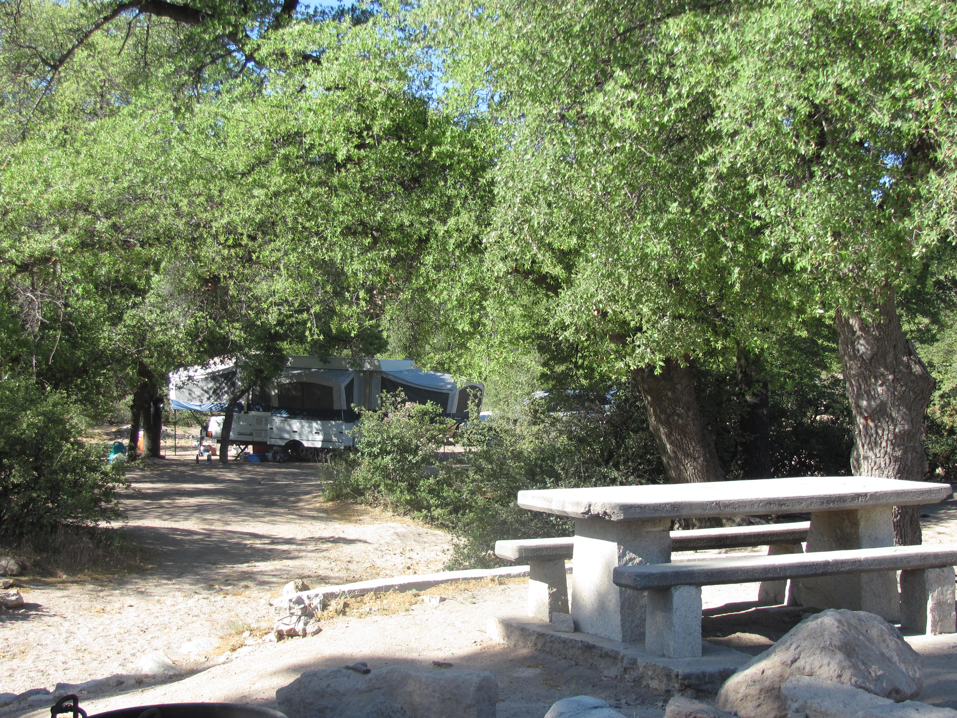
I am a resident of Arizona—for 30 years—and an avid user of our wonderful National Forests. I am grateful to President Theodore Roosevelt for setting aside forested areas here in the Southwest. If it had not been for his foresight (and that of several previous Presidents), there would not be a tree left in the Western United States. Personally, I want to continue enjoying the National Forests and the benefits they bring to my health and well-being—and the health of the planet.
See trees destined for destruction at the bottom of a meteor crater: http://www.mining-law-reform.info/Save-our-Trees.htm
I find many unanswered questions on the issue of trading centuries-old oak trees at Oak Flat campground for parcels of burnt-out ranch land. Even the Tonto Forest Service personnel have deemed these swap properties unsuitable for any public use, such as a campground. Not one of the swap plots contains even one century-old oak tree, but only mesquite trees, considered invasive weed trees. These trees are not old-growth, they are the result of cattle ranching in the late 1800's and nearly 1900's. Consequently, the native, natural grasslands were destroyed and mesquites and cactus filled in.
See photos of exchange properties:
http://www.mining-law-reform.info/LandSwap.htm
In addition to destroying trees that provide clean air and water, habitat for wildlife, and shade for human recreation, the present Congress would be bypassing the laws created by past Congresses by enacting the Land Swap Bill HR-687. In 1891 through 1916, lands were set aside for protection of the forestsfor future generations.
When President Roosevelt created the nation's forest system, he created a separate entity to manage them and placed them under the Agriculture Department. Minerals are not agriculture. Forests in the northwest and east were to be managed for sustainable logging. Forests in the southwest were to be protected to preserve rivers, streams and ponds to gather and conserve rain to provide water for the growing western cities. All National Forests were created and preserved, as in the case of Oak Flat, by Presidential Orders. See report on wildlife in Oak Flat region: http://www.mining-law-reform.info/Wildlife.htm
The following questions need to be addressed and are discussed in sections below:
I. Safety issues
II. Economic considerations, including the number of jobs
III. Ramifications of having a mile wide and deep crater in the area with corresponding waste piles
IV. Depletion of groundwater and surface water levels
Rio Tinto information states they have five underground projects across the United States and Canada. [See http://resolutioncopper.com/about-us/ (under Tom Goodell)] Has there been an inquiry into the safety records at these five mines? Photos of the recent landslide at Rio Tinto's Kennecott operations: http://blog.skytruth.org/2013/04/landslide-at-bingham-canyon-mine-utah.html
Mining fatalities are a reality. While Rio Tinto's Resolution copper operation has had only one fatality (Note 1), one serious injury (Note 2), and dozens of accidents (Note 3), the old underground Magma mine that Rio Tinto has taken over had two major cave-ins in recent history that took the lives of eight miners. Four men were killed in a triple cave-in in 1982 and another four in 1993. Superior's retired miners and residents remember the tragedies; therefore, many refuse to work underground.
These tragedies do indicate unstable conditions for retrieving ore. The region was formed and inundated by volcanic action a million years ago that left unknown rifts and fractures in an irregular layer from 1,000 to 2,000 feet thick, including the forming of Apache Leap. Further, the area below the tuff is riddled with a network of 200 miles of tunnels constructed by the former operator. How will these tunnels affect the stability of the land/bedrock mass that is being excavated?
Media notices of the deaths of eight men at Magma operations due to two cave-ins that denote the unstable conditions of the mining area:
May 10, 1982
Magma Copper Company; Magma Mine Cave-in http://www.usmra.com/saxsewell/magma.htm
Superior, Pinal County, Arizona
Number Killed 4: Joey Granillo, Superior; Spaghetti Joe Foreman from New York; Martinez from New Mexico; Unknown]
On May 4, 1982, blasting was conducted in the Magma Mine, an underground copper mine. Distracted by deteriorating tramway conditions, miners failed to quickly follow-up this blasting with timbering.
As a result of this delay, ground control problems were encountered on May 10. At about 2:40 a.m., as two miners were responding to these problems by barring down some loose ground near timbers, a cave-in suddenly occurred without warning. One of the miners was trapped in the collapse.
After unsuccessfully attempting to free the trapped miner, the other miner summoned three miners who were working in an adjacent area. Their rescue attempts went awry when one of the rescuers removed a steel bar near the trapped miner, triggering a second cave-in. This collapse fatally injured another miner.
Shortly thereafter, a third cave-in occurred. This collapse killed the trapped miner as well as a fourth individual. MSHA investigators attributed the disaster to the failure of temporary ground support. The lag time between blasting and the installation of permanent ground supports also contributed to the disaster.
______________________________ _____
MAGMA COPPER CO. ANNOUNCES FATALITIES AT SUPERIOR MINING DIVISION
http://www.thefreelibrary.com/Magma+Copper+Co.+announces+fatalities+at+Superior+mining+division-a013222311
TUCSON, Ariz., Aug. 11, 1993/PRNewswire/ Magma Copper Co. (NYSE: MCU) today reported an ore slide in one of the ore passes at Magma Copper Co.'s underground mine in Superior, Ariz., (60 miles east of Phoenix) has resulted in four fatalities. There were no other injuries.
Dead are John H. Dalton, 38, of Miami, Jeff Christiansen, 21, from Claypool, Alfred Edwards, 56, of Globe, and Nicholas P. Truett, 19, from Superior. Dalton was a group leader, Edwards a team leader and Christiansen and Truett were support technicians at the mine.
It appears the men were unaware that the ore became dislodged while they were working. The sudden impact of approximately 50 to 60 tons of ore took out approximately 150 feet of the timber and steel retaining wall that separated the manway from the ore pass, McGregor said. As a result, they were buried beneath the ore and timber rubble.
Does the use of robots increase safety?
In Rio Tinto presentations, they show that they definitely will be using robots in their Resolution project. Does this method increase the safety for the underground miners? Mining companies Rio Tinto and BHP are the leaders in promoting and using remotely operated equipment in their mining operations. The robots solve two problems
1) Difficulty finding technical personnel to work in remote areas with no access to entertainment and the good life.
2) Eliminating the danger to personnel working in a hazardous situationsuch as 7,000 ft. below surface. Along with the cave-in potential, temperatures at 7,000 ft. below surface also have to be taken into account.
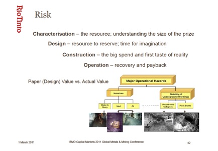
In Rio Tinto's presentation in a 2011 BMO Capital Markets Mining Workshop of 56 pages on block-caving mining, they emphasize the financial gains for the company in processing low-grade ores, while giving no assessment of the environmental impacts of the thousands of tons of waste and slurry. There is one slide on the safety risks with a category of Major Operational Hazards.
BMO Capital Markets 2011 Global Metals and Mining Conference
An Introduction to Block and Panel Caving
Allan Moss, General Manager
Rio Tinto Copper Projects
Slide 42:
_________
Entire presentation: http://www.femp.org/wp-content/uploads/2011/07/CAT-workshop-Rio-Tinto-Block-Caving.pdf
Only slide 42 deals with risks, however, the remainder of the 56-slide presentation is informative.
Note that one of the major hazards is inrushes of Water and Slurry or Mud. For the past four years, Resolution Copper has continuously been pumping water from Shaft 9 and the new Shaft 10. Water and mud is a danger for automated operations and there is water at Apache Leap. Resolution Copper is required to submit an annual report of water use (even though it is dewatering, the water goes to farm/ranch use in Pinal County) to the state Arizona Department Water Resources (ADWR) the volume of the water. With the low rainfall for the past year, the continuous pumping24 hours a dayis now at 700 to 800 gallons per minute, but for four years the rate was at 2,000 gallons per minute. Following are the totals from ADWR records:
2009: 1696.71 AF = 552,837,323 gallons
2010: 2004.00 AF = 652,961,316 gallons
2011: 1912.00 AF = 622,985,048 gallons
2012: 1287.00 AF = 419,341,923 gallonsTOTAL 6,899.71 AF = 2,248,225,610 gallons
[Source: AzDeptWaterResources: http://infoshare.azwater.gov/docushare/dsweb/HomePage ]
At the time of closure of the Magma Mine in 1986, an average of 450 gallons per minute (gpm) was being continuously pumped out of the tunnel system from various pumping stations. Maximum pumping rates (1200 gallons per minute) occurred after heavy rainfalls and when water flowed in Queen Creek. So this is not just stagnant, accumulated water; there is a steady inflow of water into the mining site. At the SME annual meeting in Denver in March 2011, Resolution Copper personnel gave a paper that estimated that they would be dealing with about 300 million gallons per year of new inflow. [See Resolution Report: Dewatering, Treatment and Beneficial Reuse of Water from the Resolution Copper Mine http://dc312.4shared.com/doc/s8KUX5Uu/preview.html ]
In fact, in 2003, American Insurance Group (AIG) denied ASARCO insurance coverage when they were considering reopening the mining operation at Oak Flat/Apache Leap because of the high risk factor . not only for the employees, but AIG assessed that the underground blasting would make the nearby climbing areas unpredictably unstable and therefore unsafe for recreational climbers. The entire southwest is an an earthquake zone. The geology of the region has been studied extensively by both USGS and University of Arizona.
Tertiary Volcanic Rocks of the Mineral Mountain and Teapot Mountain Quadrangles, Pinal County, Arizona
By William J. Keith, Ted G. Theodore
US Geological Survey; Open-File Report 79-716, 1979.
The Mineral Mountain and Teapot Mountain are located in south central Arizona between Phoenix and Tucson south of the Superior volcanic fields of Royse, Sheridan, and Peirce. The quadrangles are 3 km [1.86 miles] south of the town of Superior, which is also the location of the Magma copper deposit and are about 1 km [.62 mile] west of Ray porphyry copper deposit. (page 1)
[See http://pubs.usgs.gov/of/1979/0716/report.pdf]
II. Economic considerations, including the number of jobs
Has the number of jobspresently claimed to be 3,600actually been verified? I live by the Freeport-McMoran's Sierrita, one of the largest copper and molybdenum mines in Arizona. It operates at full capacity and employees 1,200 persons for the operations. And they don't use robots as Resolution says it will be doing (see video below). Originally, the numbers given by Resolution were 450 permanent jobs and 1,200 temporary construction jobs. Therefore, the 3,600 number looks like it could be inflated.
A company spokesperson said that 2,000 of the jobs would be construction jobs to get the mine in operation. There are already buildings at the site, so the principal construction will be the struts and conveyance system at 7,000 feet (they start mining at the lowest depth). There will be no Arizonan company capable of accomplishing this kind of work. How long will these 2,000 jobs last?
What Arizonan company has the capability to build the automated loaders that will be doing the underground loading as shown in a Resolution Copper video demonstrating their operations at Apache Leap? The Resolution Copper project has an informational video showing how they will use automated loaders [at minute: 2.09] for removing for what is stated to be low-grade ore [at minute: 0.31] at their Superior operation.
Link to Resolution's video on use of robots in its operations at Superior: http://player.vimeo.com/video/50785129?title=0
At the present time and for the past three years, Freeport-McMoran and ASARCO's personnel sections have had difficulty finding any qualified personnel. I kept records in 2011 for available mining jobs in Arizona. The number ranged from 150 positions in May to 350 in November. [See http://www.mining-law-reform.info/CurrentJobs.htm ] In January 2013, there were 190 unfilled mining jobs in Arizonaat all skill levels.
Have the Congresspersons or staff taken the time to communicate with the management of Arizona mining companies to ascertain these facts? The number of mining jobs that remain unfilled in Arizona can be ascertained any time:
Job Posting sites:
Freeport-McMoran: www.JobCentral.com (Fill in company & state)
BHP Billiton Arizona: http://www.indeed.com/q-Bhp-Billiton-l-Arizona-jobs.html
ASARCO: http://www.indeed.com/jobs?q=ASARCO&l=Arizona
Golder Associates: www.jobcentral.com
Gold Canyon Mining and Construction: www.jobcentral.com
When Resolution has a rally in Superior to gather support, there are a number of miners present. I have questioned them. They are all working miners at the nearby Pinto Creek, Miami or Hayden mines. They have no intention of working at Resolution's operation.
The current operations manager and almost half of the management team are from Australia, South Africa and Canada. [See http://resolutioncopper.com/about-us/] And what taxes will the foreign managers be paying here? David Salisbury, a former operations supervisor told me, Like all corporations, Rio Tinto will not pay any Federal taxes. Senator John McCain said there would be a billion dollars in the Federal coffers, but that money will come from the federal income tax the employees pay. But what about the taxes the managers will pay?
Resolution has already shown that they use out-of-state contractors, as they used Boart Longyear out of Salt Lake City (home of Rio Tinto's Kennecott operation) to do the explorative drilling project on National Forest Lands between the Old Magma operations and Oak Flat Campground. So how many of the jobs will go to Arizonans?
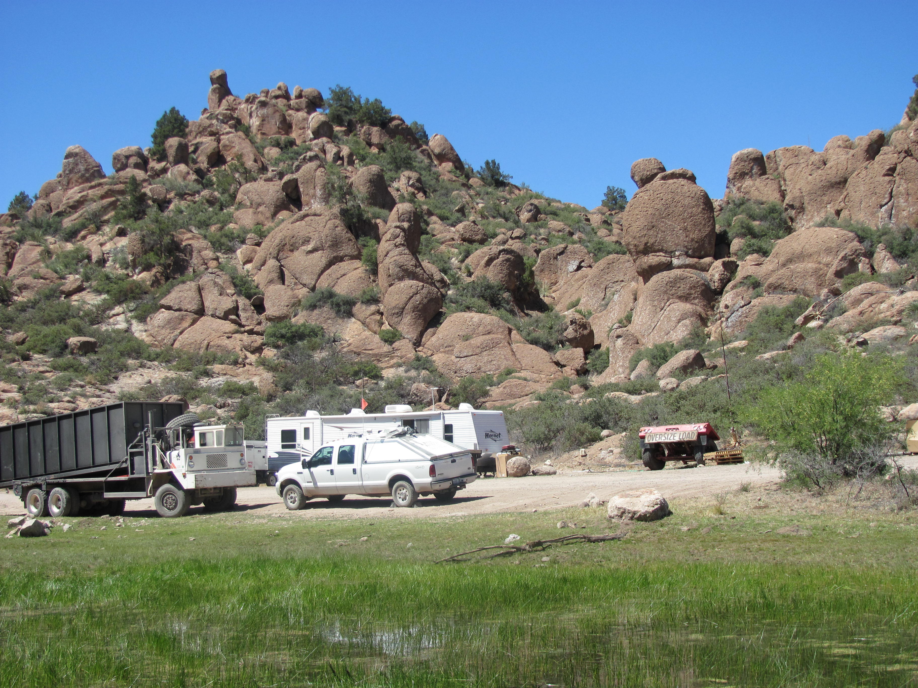
Headquarters for Resolution exploratory drilling on Tonto National Forest land

Boart Longyear Drilling Services haul truck
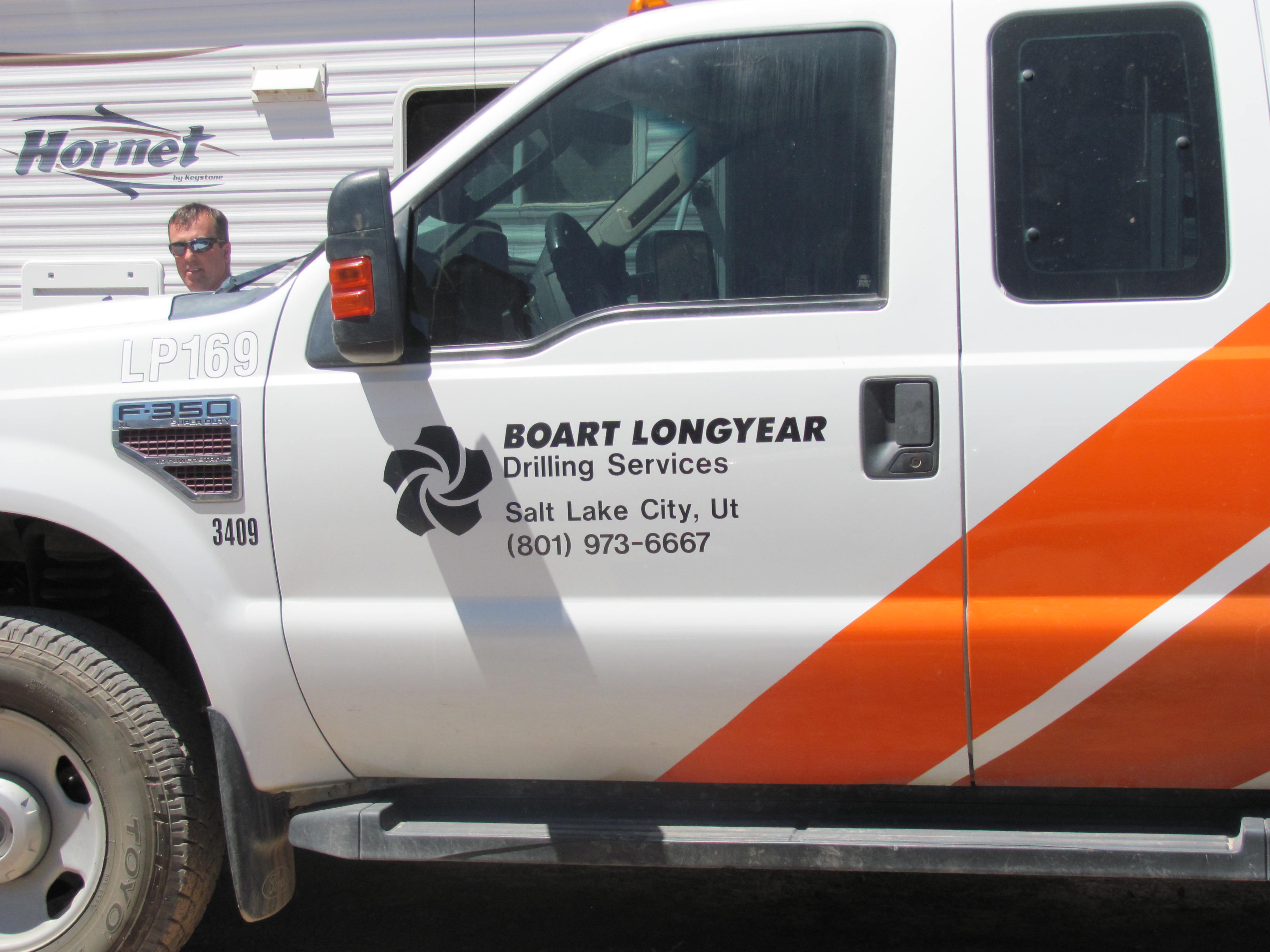
Boart Longyear Drilling, Salt Lake City, Utah
Photos taken by Nancy Freeman, March 2011, in Tonto National Forest
I always say if you want to know how mining creates prosperous communities, drive through Globe, Miami, Hayden and Ray where mining has been going on continuously for 100 years. There is not a single indication, monument or decent building that there was every any prosperity for the miners. Anyone who is pretending that mining brings prosperity to a community is perpetuating a myth. The money went to New York City investors in the past, and now goes to foreign investors.
III. Ramifications of having mile wide and deep crater in the area with corresponding waste piles from the diggings
The long-term ramification of having another meteor crater in a populated area in Arizona is a total unknown. Obviously, Resolution copper knew it was major issue because they denied that there would be subsidence for at least 4 years. Even Madan Singh, the former Director of the Arizona Department of Mines and Mineral Resources, stated, Subsidence is an inevitable consequence of underground mining it may be small and localized or extend over large areas, it may be immediate or delayed for many years.
Finally, in 2009, Resolution Copper admitted there would be subsidence the size of Arizona's Meteor Crater, which is nearly one mile across, 2.4 miles in circumference and more than 570 feet deep. No reclamation plan deals with this huge crater and no reclamation plan can deal with this huge crater. See map [Note: This map came from Resolution Copper's website [ http://resolutioncopper.com/images/sp_large.jpg ] in 2009, but they have since removed it from their website. This crater will create a cone of depression that will draw surface water into it. The water that normally flows from Oak Flat to Devil's Canyon will be obstructed.
If there is crater, it is a given there will be a mountain created of equal size somewhere, minus the 2.0 % estimate of copper and moly extracted. Where that mountain will be created has not been determined, but the mountain will be a great burden on the surrounding landscape and watershed of the Tonto National Forest, not only for its size, but also for its contents of milled heavy metals that can be released to the environment. Will the heavy metals include radioactive components that are so prevalent in Arizona's bedrock that when the EPA published a study on technologically enhanced radioactive materials (TENORM), the analysis had been conducted in Arizona mine sites: [See http://www.mining-law-reform.info/EPA%20TENORM.pdf ]
IV. Depletion of groundwater and surface water levels
One must take into account the critical situation of water levels in Arizona, which have been lowering continuously for the past 100 years. When President Roosevelt created National Forests in order for the population of the Southwest to have sufficient water, he had no idea of the impact that modern pit mining and subsidized cotton farming would take on Arizona's water supply.
To alleviate the problem, the Federal Government subsidized Central Arizona Project (CAP)the largest and most expensive aqueduct system ever constructed in the United States at a cost of $3 billion to taxpayers. The project was envisioned to provide water to nearly one million acres of irrigated subsidized cotton land in Maricopa, Pinal and Pima counties, as well as municipal water for metropolitan areas of Phoenix and Tucson. However, the problems of lowering water tables continues, especially east of Phoenix: http://www.azwater.gov/AzDWR/Hydrology/Geophysics/documents/LandSubsidenceInArizonaFactSheet_003.pdf
While hundreds of government personnel are attempting to alleviate Arizona's continuing groundwater deficit, Resolution Cooper will be using major amounts of water. The Freeport-McMoran Sierrita mine's water use for processing the ore is at 27,000 acre feet per year.
[Source: http://mines.az.gov/Publications/sr29WaterConsumptionCopperMines.pdf, Page 6]
Where will Resolution get their supply water? Since there is no Mining Plan of Operations, this question remains unanswered. At a recent meeting with the Globe Town Council meeting, a Resolution Copper hydrologist gave a presentation.
Resolution Mine Answers [Water] Worries By Ed Kuehneman
Copper Country News, Globe, Arizona
Resolution Copper's hydrologist Greg Ghidotti explains that the new mine would not use the region's groundwater.
On April 15, Resolution Copper gave Globe Council a report on technical aspects of its proposed mine. Power Point images and video footage accompanied brief presentations by staff, focusing on aspects that opponents of the project have questioned. Specialists explained:
Where will the mine water come from? Not from groundwater there isn't enough. Not even from the region. Credits for CAP surface water (from the Colorado River) are already being built up for years of mine operation. [Freeman's Note: They will be using only groundwater. Their CAP water has been used by the Magma Irrigation Districtso they now have credits to pump groundwater. Magma used wells from Florence Junction, and Resolution used water from there for their reclamation project (200,000 gallons per day).]
Why are Queen Valley wells drying up? They are dependent on rain, and there's a drought. Magma used to dump excess storm water into Queen Creek, but there's no more Magma Mine. [Freeman's Note: If there has been a drought, where are the 800 gallons per minute that Resolution is pumping daily coming from? It is almost twice the amount that Magma was pumping daily. Magma Mine has been closed for over 25 years, so any effects of their dumping of excess storm water has not affected the Creek or groundwater levels in decades.]
Would a big Resolution mine pull water from Globe-Miami, Superior or Queen Creek? No, they're not even in the same basins, said hydrologist Greg Ghidotti. Especially in the more-solid-rock mountains, water doesn't travel easily. Resolution pumped water out of the old Magma shaft and watched the levels in test shafts nearby. Levels didn't fall some actually went up. [Freeman's Note: If any water levels went up, obviously, water is being pulled into the area by the cone of depression created by the dewatering pumpingfrom where?]
Why block cave mining? Why not the old Magma style with narrow tunnels? Following rich veins, Magma mined 5 per cent copper. The new ore body is about a mile square, but it's deeper (7,000 feet) and only 1½ per cent copper. The block cave method is more economically appropriate.
Will it leave a big hole? Block cave miners will go under the ore body and pull it out as gravity pulls the ore down. The square-mile surface will gradually drop as ore deep underground is removed, starting on the side farthest from Apache Leap. Subsidence would be monitored constantly. The final result will be a shallow bowl-shaped depression 1,000 feet deep in the middle and 500 feet deeper on average, but the top will just be lower, not scraped off like an open-pit mine.
Will the tailings contaminate Superior water? A tailings site must be found that is geologically appropriate (not porous) and acid-containing waste will be surrounded by neutral waste. Monitor shafts nearby will watch for leakage. None of the proposed sites are even close to Superior water sources, but public input will be sought on a suitable location. [Freeman's Note: Most of the Superior residents get their water from Arizona Water Company from their Florence Junction wells, which is the system that Magma set-up to provide clean water to the residents--and the public water storage tanks are on Resolution Copper property.]
Where's the plan of operations and the NEPA study? They're due to come out this year. One delay was the tailings locationthe Pinto Valley mine site idea was finally abandoned. (It's still a useful mine.) Other sites are being researched. Approvals and bonding are in future stages. Resolution will have to satisfy over 50 different federal, state, and local permits before mining begins.
There was a time for questions and Resolution staff were available afterwards, but there was not a word from the mine's detractors.
[Thanks to Ed Kuehneman for permission to use his story as printed in Benson's "Copper Country News"]
________________________________
Resolution has over 150 wells listed on the ADWR well inventory. However, there is sparse information on the pumping from most of wells. Further, the Other category of 48 wells remains undefined. However, many of the Other category were drilled to 7,000 feet, so it is not likely that the wells are used to pump water.
Resolution Wells from Arizona Department of Water Resources Records
Non-exempt industrial wells (depths 1,000 to 6,000 ft) = 7
Exempt wells (exempt from record-keeping) = 2
Monitor wells = 94
Other wells = 48
[Source https://gisweb.azwater.gov/waterresourcedata/WellRegistry.aspx ]
Resolution's water rights permits:
58-117402.0001 (Type 2 mineral extraction: Phoenix AMA) (2005 2012) = 505.5 af
58-130703.0001 (Type 2 mineral extraction: Phoenix AMA) (2005-2012) 0 af
59-524492.0003 (Dewatering permit: Phoenix AMA) = 6,899.71 af
[Withdrawal authority allotment=5000 af; permit expiration date 9/20/2029]
73-534489.0500 (Water storage permit: Pinal AMA(2005-2012) 0 af
73-584466.1500 (Water storage permit)
73-569775.1600 (Water storage permit)
Resolution also has additional sources of water. During the reclamation efforts by Resolution at the old Magma smelter and mill site, they purchased water from Arizona Water Company, reported at a public meeting with the Superior Town Council to be some 200,000 gallons a month during their reclamation project at the old mill, smelter and tailings site. This source of water from the Florence Junction well field serves communities. What effect will it have on current users? In Arizona, there are statutes regarding transfers of water out of the service area, out of the sub-basin, and out of the Active Management Area AMA). The statutes that address transportation of groundwater in relation to AMAs are in 45-541 thru 45-545.
Resolution Copper states on its website:
We are planning prudently for the future water needs of our mining project. We have already purchased and banked excess Central Arizona Project (CAP) water to meet about half of our mining needs. [http://resolutioncopper.com/the-project/water-management]
Note that Resolution Copper is planning for the water needs of their mining project with no planning whatsoever for the future water levels in the region. Further, they have misstated their banked water, for that water has been delivered and used by the New Magma Irrigation District, as is stated on the Resolution website:
James [Almaas] is responsible for mine water treatment operations and our 27-mile-long pipeline from the company's mine site to the Central Arizona Project (CAP) canal, where our treated mine water is blended and used for beneficial agricultural use. [emphasis added] http://resolutioncopper.com/about-us/
Resolution has water credits to pump groundwater from wherever they please (mining is exempt from the Groundwater Code in Arizona). What will this pumping mean to the public water supply in the North Florence well field where traditionally the former mine, Magma, had its supply wells? I have contacted Arizona Water Company, which furnishes water to Superior, with this question. To date, I have not received a reply.
The water situation in Arizona is in crisis. Arizona State is running a campaign for residents to conserve water:
http://wateruseitwisely.com/join-the-cause/contact.php. However, they don't want anyone washing their driveway down, yet the officials do nothing about high water users like cotton and copper.
In addition to the misleading statement about their banked water, which has actually been used by Magma irrigation district, in 2007 Resolution also planned to ignore with the Clean Water Act by dumping two billion gallons of toxic water out of the old Magma Mine shaft 9 into Queen Creek, which flowed through Superior and on further behind Boyce Thompson Arboretum State Park. Fortunately, the Arboretum management objected and notified the Arizona Department of Environmental Quality was notified. ADEQ required Resolution Copper to obtain a discharge permit and purify the water. Even after treatment, the water still had to be mixed with other water to be of a quality to use on crops. That is to way when it comes to water, Resolution Copper officials do not seem to have a clear concept of Federal or Arizona water statutes.
There needs to be a complete modeling of the hydrology of the region and the impact on private wells in Superior region, including wells up to and including the town of Top of the World and private ranchers in the region. Resolution Copper needs to be proactive in analyzing the regional hydrology. There are Federal Regulations concerning depleting water in the National Forest (and any reserve of public lands).
When the United States reserves public land for uses such as Indian reservations, military reservations, national parks, forest, or monuments, it also implicitly reserves sufficient water to satisfy the purposes for which the reservation was created.
This mandate was established in 1908 by Winters v. United States: www.blm.gov/pgdata/etc/medialib/blm/co/field_offices/denca/DENCA_Advisory_Council/extra_materials_for.Par.33214.File.dat/FedResWaterRights.pdf Subsequent laws have watered down the original intent. However, in a case in 1999 in Arizona regarding water on BLM reservation land reaffirmed the Federal rights are still in tact. The presiding judge wrote, The [Winter's] doctrine applies not only to Indian reservations, but to other federal enclaves, such as national parks, forests, monuments, military bases, and wildlife preserves.
The Federal rights to water in our public lands, including National Forests were reasserted again in the Gila River Adjudication in Arizona:
SUPREME COURT OF ARIZONA
195 Ariz. 411;989 P.2d 739;1999 Ariz.
http://www.g-a-l.info/AZAdjudication.htm
From Opinion by Judge Noel A. Fidel:
The reserved water rights doctrine provides:
When the Federal Government withdraws its land from the public domain and reserves it for a federal purpose, the Government, by implication, reserves appurtenant water then unappropriated to the extent needed to accomplish the purpose of the reservation. In so doing the United States acquires a reserved right in unappropriated water which vests on the date of the reservation and is superior to the rights of future appropriators.
Cappaert v. United States, 426 U.S. 128, 138, 48 L. Ed. 2d 523, 96 S. Ct. 2062 (1976). The doctrine applies not only to Indian reservations, but to other federal enclaves, such as national parks, forests, monuments, military bases, and wildlife preserves.
Id. at 138-39;Arizona v. California, 373 U.S. 546, 601, 10 L. Ed. 2d 542, 83 S. Ct. 1468 (1963).
For additional information: http://www.g-a-l.info/Protection2.htm
Further, as noted above in Section III. Ramifications of having mile wide and deep crater in the area with corresponding waste piles from the diggings, the sump caused by subsidence will dewater the surrounding forests and private ranchers' wells in the region and will serve as a catchment basin for the rainwater that would have been delivered to Devil's Creek.
Since Resolution Copper has no Mining Plan of Operations, they have not assessed the potential regional water issuesbut they are working on their own water supplies, the sources of which have not yet been disclosed.
In the January, 2000, U. S. Forest Service report: Water and the Forest Service , [http://www.stream.fs.fed.us/publications/PDFs/Water_and_FS.pdf] created by the FS National Headquarters (with taxpayers money) emphasizes the importance of forests for maintaining a viable, clean water supply. Certainly, the situation has not changed, only worsened, in thirteen years. The Forest Service is not living up to its own publicly-stated mission and goalsor well researched reports.
In early 2012, Elizabeth Bernays, Regents' Professor Emeritus, University of Arizona, wrote an appeal regarding mining in southern Arizona that was signed by 333 members of the academic communityin U.S. and other countries. Many individuals are seriously concerned about the possibility of intensive mining in Arizona, where water is very short and precious, and biodiversity is unusually high. Take any acre in an Arizona National Forest and I guarantee, you will find more diversity in flora, fauna, reptiles and insects than any forest in any other state. The diversity never ceases to amaze meand I have lived in wooded regions in Vermont, northern California, and the Sam Houston National Forest.
See letter: http://www.earthworksaction.org/files/publications/letter_with_professors.pdf
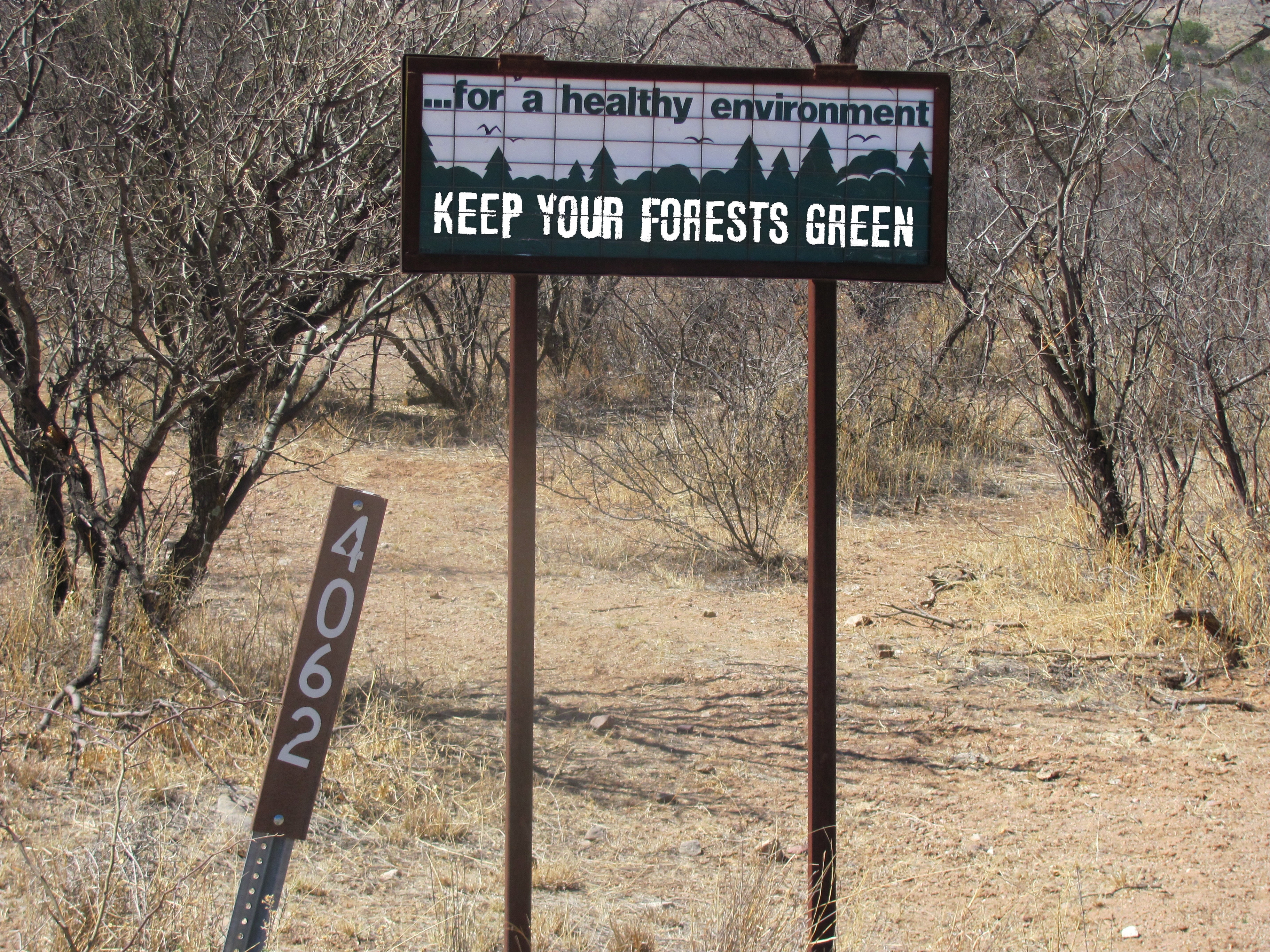
Forest Service Sign in Coronado National Forest
Destruction of our National Forests through purposeful operations that will destroy the vegetation, habitat and watershed forever is not an option for a healthy environment and healthy people. The mission of the USDA Forest Service is to sustain the health, diversity, and productivity of the Nation's forests and grasslands to meet the needs of present and future generations.
I implore you to help the Forest Service keep their promise to the public by protecting Oak Flat for the enjoyment of future generations.